In 1990, Congress established the 1,200 mile Juan Bautista de Anza National Historic Trail in order to commemorate the astonishing 1775 journey of over 240 colonists, men and women of diverse heritage who traveled from northern Mexico in order to create a settlement at what is now San Francisco. The idea was to help Spain bolster its presence in Alta California and to counter encroachments by England and Russia. Led by Juan Bautista de Anza—a lieutenant colonel who had the year before explored a new land route from Mexico to the mission San Gabriel—and accompanied by the expedition’s spiritual leader, Father Pedro Font, these colonists and their livestock tramped through forbidding terrain, especially during the early part of the journey, which took them through daunting desert landscapes. Much of that terrain is now set aside as the Anza Borrego Desert State Park, yet another government acknowledgment of the importance of Anza’s achievement.
Anza and Font kept meticulous diaries of their experiences, especially the good padre who considerably expanded his trail diary after the journey. It’s especially notable for the level of detail about the trip and the unvarnished opinions of its author.
The National Park Service, guided in part through these diaries and benefitting from much subsequent research, administers the trail and offers the public, among other things, robust digital portals that document the history of the expedition and mark its course. One online resource explains that the Anza “trail” is really a “Historic Corridor,” pointing out that since “the expedition was made up of 300 people and a 1,000 head of livestock, the width of the corridor changes with the topography of the landscape. In an open valley, the[y] may have spread out and in a canyon, the expedition would’ve narrowed. On a map, the corridor is a theoretical line that overlays the modern landscape.” Digital materials also direct interested people how to access sites—now embedded in a much-changed contemporary landscape and many marked by exhibits and monuments—located along the length of the trail, some of these sites accessible by foot and many even by automobile. In essence, the National Park Service invites you to experience California history through the medium of your own senses. And it works.
Kind of.
Fool’s Errand
I’ve been familiar with parts of the trail for a long time, partly from walking local Central Coast trails marked with occasional exhibits detailing the history of the Anza expedition, some of these illustrated with drawings or pictures from historical reenactments. But I wanted to see some of the trail terrain closer to the beginning of the JUBA (Juan Batiste de Anza) Corridor, namely the area in and around the Anza Borrego Desert State Park, partly because I was unfamiliar with the area, and partly to see just how hair raising the terrain could be. After all, there’s got to be something especially sinister about a region that includes an area called the Ocotillo Badlands.
To some degree, of course, chasing Font’s experiences is a fool’s errand.
Thanks to the National Park Service’s curation of the corridor, and the exhibits and trail markers that appear throughout its length, inevitably visiting sections of the corridor can seem a little like visiting Disneyland through the medium of pre-formulated picture spots. I’m reminded of Walker Percy’s 1954 essay “The Loss of the Creature,” wherein Percy explores how unexamined cultural influences frame our sense of whatever “creature” we might encounter and thus rob us of our sovereignty over our own experiences.
One of Percy’s creatures is the Grand Canyon, where he describes how tourists strive to think of their experience of the great chasm as a pure, innocent, face-to-face encounter, akin to that of Garcia Lopez de Cardenas, the first European explorer to take in the grandeur of the canyon. But alas, many fail to appreciate that howsoever much the majesty of the Grand Canyon fills their senses, their encounter is inevitably filtered through their exposure to, among other things, history books and postcards and even, I would add, music (think Ferde Grofé’s earworm Grand Canyon Suite and, once again, Disney). All of these elements provide a complex template that influences how sometimes anxious visitors unconsciously measure what seeing the Grand Canyon should be like. Of course, these folks like to take pictures to document that experience for friends, who are invited to judge the authenticity of it, sort of giving up another tidbit of sovereignty.
Thus when visiting the Anza Trail, it’s important to remember that the “creature” isn’t the landscape by itself but the landscape mediated for us by the diaries of men like Anza and Font and the subsequent cultural production that has come after, yielding histories, monuments, and even the work of imaginative travel writers. Here’s J. Smeaton Chase writing of the Borrego Springs area in his 1919 classic California Desert Trails: “I turned now northwesterly, following the route taken (as I think likely) by Anza and his fellow explorers” (214). Today, you can’t escape, for example, the paved highways, the off-highway vehicle areas, and the aircraft landing strips, all modern material goodies that are nestled in the area in and around the Anza Borrego Desert. But being aware of them also means you can, at least to some degree, squint a little bit and set them outside your gaze, which perhaps is one way to stave off the anxiety that Percy writes about.

I should say that Percy’s point could apply to many of our posts that retrieve historical and literary depictions of California landscapes. But unlike, say, comparing Mark Twain’s descriptions of Lake Tahoe to contemporary experience, the trail markers, plaques, roadside exhibits, and multimedia online sources of the Juan Bautista de Anza National Historic Trail seem to invite a particular, pre-digested experience. It’s useful to chew on that idea, even if, like me, you largely like the materials. Of course, it’s good to acknowledge that some of them are embedded with an unfortunate romanticism that tends to overlook the harm to native people caused by the expedition, and some of them offer damaging assumptions about race, especially the diaries.
Dark Skies
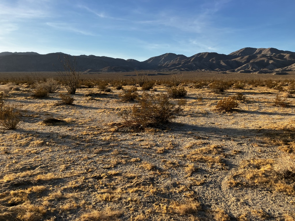
The Borrego Springs area manifests the essential contradictions that are endemic to much of California. Though it’s a region that celebrates its natural and cultural history, preserving the desert region, cultivating appreciation for the native plants and wildlife—from barrel cactus and teddy bear cholla to road runners and bighorn sheep—it’s also home to metal dinosaur sculptures, high-toned golf links, and really popular OHV trails.
Still, it’s pretty clear that here the desert ecology is in charge, from the short-lived, seemingly improbable springtime wildflower bloom events that draw onlookers from all over the world to the indigo night-time sky strewn with stars (Borrego Springs is a certified Dark Sky Community). I was there during the middle of December, the same time of year that the Anza expedition entered the area at Christmastime, almost 250 years ago. The building and landscape lighting was weirdly dim, making it hard to see your way at night, even in town. But the stars were startlingly bright. When the Anza expedition was here in December 1775, however, the colonists would have had a hard time seeing them, thanks to some really miserable weather.
After crossing what is now the border with Mexico, Anza led the expedition north. On a contemporary map, you can see that he was following West Mesa between the Superstition Hills and the Fish Creek Mountains. On December 13, the party established a camp at a place Anza had named San Sebastián. The name was inspired by Anza’s guide, Sebastián Tarabal, during Anza’s first journey through the area in March the year before. At the time, he wrote, “I named it San Sebastián, alias del Peregrino, because the already mentioned native of California had come out through here” (Bolton, V. 2, 81-82). Font described the place this way:
This place of San Sebastian is a spring of water that is rather hot or warm when it emerges, deep and permanent, like a marsh, and flowing very little. It has its carrizo and some grass, although it is not very good, because the soil is so saline in all this flat that in places the salt whitens it like flour. But the water does not appear to be very bad, although near the spring there is a ditch which is very miry, with the worst kind of water and very injurious. There is also some firewood of scrubby mesquite. (Bolton, V. 4, 130)
From there, the expedition traveled more or less northwest, establishing four more campsites in the immediate area of Borrego Springs. The last of these, at Santa Catharina Springs, was nestled in Coyote Canyon, which climbs north, leading out of the Borrego Valley. They left this place on December 24, following the canyon and heading toward the Cahuilla Valley. But while they were in the area, it rained or snowed almost the entire time. Astonishing, since the annual rainfall in Borrego Springs hovers around 3 inches a year.
How serious was the danger from the storm? Colonists were divided according to their progress on their journey. Father Font and Anza were anxious:
In the afternoon the lieutenant arrived with the third division of the people of the expedition, having had some delays on the way. These were due to the fact that the cold weather obliged them to spend three days going from El Carrizal to Santa Rosa, where they arrived on the 14th half dead from thirst and cold, because of the snow which caught them on the road. This, together with the cold, had such a disastrous effect on the mules and horses that fifteen remained on the road lost or dead. And may God be thanked that the people escaped with their lives, without anyone dying or becoming ill, for this was no small marvel. On the 15th they remained at Santa Rosa, whence they set out yesterday, and it has been a great pleasure to all that they should arrive today, whereby we have succeeded in being reunited to continue the journey, with the favor of God. (Bolton, V. 4, 136)
The haywire weather experienced by the Anza colonists is memorialized in a wayside interpretive panel at Highway 78 and Los Feliz Wash: “Despite the freak storm, Anza led his 200 people safely through the freezing conditions. Only a few horses and cattle perished from the cold.” Perhaps their stormy perils made the earthquake they felt a few days later seem like small beer.
According to historical seismologist Max Suter, this was the second earliest documented event in southern California’s earthquake history, reaching a 5 on the Modified Mercalli Intensity Scale. Both Font and Anza noted it in their diaries, but almost as an afterthought. Here’s Anza: “Rain continued until half past four in the afternoon. After it began to get dark a heavy, distant thunder was heard, and this was followed by an earthquake which lasted four minutes” (Bolton, V. 3, 71-72).
Borrego Valley
As we’ve seen, between the onset of stormy weather and the rumblings of the earthquake, the Anza expedition had traversed terrain leading to and through the Borrego Valley. Much of what the diarists recorded will be largely familiar to contemporary visitors. According to Vladimir Guerrero, Father Font—ill from flux, perennially judgmental, and occasionally disdainful of Anza’s leadership—was a superior diarist, partly because of “excellent mastery of the language” but also because he was “prolific and meticulous in his observation of (sometimes irrelevant) detail” (xviii). These details often included descriptions of the terrain, including plant life–and much of that terrain, howsoever altered by human busyness, is pretty much the same today: awesome.
Here’s a good example, Font’s description of the terrain about the campsite at San Sebastián:
Monday, December 18: We set out from San Sebastián at one o’clock in the afternoon, and at half past four halted at a flat with some galleta grass but without water, having traveled some four leagues west by north. The road is level, with sandy but firm soil, having some mussel shells and sea snails. Only on leaving San Sebastian are there some barrancas and some miry places, but all the flat is of soil so salty that it is as white as if flour had been scattered over it. After going about two leagues we came to a very small abandoned village, and on the whole march there is nothing more than now and then a scrubby mesquite and the hediondilla. The road runs near some hills in order to get to a valley through which to cross the Sierra Madre. — Four leagues. (Bolton, V. 4, 140)
Hediondilla is the creosote bush, Larrea tridentate, sometimes called greasewood. It grows throughout North American deserts and is still common throughout the Borrego Valley. Font mentions it again in a later passage, describing the terrain between the Anza campsite at San Gregorio, in the Borrego Valley, and the campsite at El Vado, near the mouth of Coyote Canyon:
Wednesday, December 20: The road is level, although somewhat sandy, and in the whole distance there is nothing but chamizo and hediondilla, and in this place a little galleta grass and choya, with which the cattle entertained themselves. (Bolton, V. 4, 142)
A little literary finesse from the perennially dour priest. I wonder if he was jealous of partying cattle?
Further up the canyon, Font returns to what seems to be a constant theme, the presence of hediondilla, but this time, he’s sensing something more sinister in it, and that sense colors his judgment of the surrounding landscape:
Saturday, December 23: This place is in a canyon which continues to ascend, and along which runs the road that crosses the Sierra Madre de California. The canyon is formed by various high and very rocky hills, or better, by great mountains of rocks, boulders, and smaller stones which look as if they had been brought and piled up there, like the sweepings of the world. Consequently it is arid, fruitless, and without trees or any green thing. Of grass in this place there is none, and on the way there are only a few small willows on the banks of the arroyo. The road in places is somewhat broken and grown with shrubs or brush and a little hediondilla, for since this is a shrub of evil augury, it is not lacking in these salty and worthless lands. (Bolton, V. 4, 144)
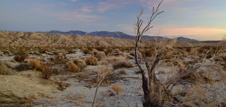
This overwhelmingly strange and beautiful desert region, I think, is not at all worthless, a conclusion certainly shared by the many people who have visited here and appreciated the stark power over human senses that the land wields here.
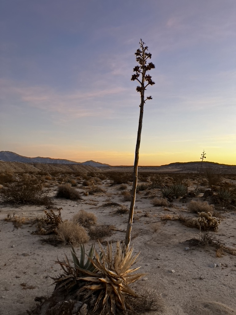
It’s still possible to turn your back on the admittedly fun and interesting modern human offerings and face the desert, to try to see it just as the diarists of the second Anza Expedition told us that they did. Eerie, dominated by strange plants, especially the thorny ocotillo and the desert agave, both of which rise above the white, course desert sands and pierce the line of the mountain horizons that surround the area. But it’s also possible, per Walker Percy, to include the human offerings in your gaze, to create an instructive contrast between a nearly seamless, Anza-like experience of the desert and a clearly not-so-seamless modern experience of the region, one mediated by the many who have touched this place, diarists, star gazers, artists, folks at the National Park Service, and countless scholars and volunteers who add to our knowledge of the expedition, including by debunking some of the unseemly romance that has attached to it.
Call it an experiential time trail.
Sources
Photos by the author.
“Anza Expedition Members.” Juan Bautista de Anza National Historic Trail. National Park Service. Updated 12 June 2024. https://www.nps.gov/juba/learn/historyculture/people.htm. Accessed 27 January 2025.
Bolton, Herbert Eugene, Anza’s California Expeditions, Vol. 1: An Outpost of Empire. U of California P, 1930. California Digital Library. urn:oclc:record:1040017901.
—. Ed. and Trans. Anza’s California Expeditions, Vol. 2: Opening a Land Route to California, Diaries of Anza, Díaz, Garcés, and Palóu. U of California P, 1930. California Digital Library. urn:oclc:record:1039983801.
—. Ed. and Trans. Anza’s California Expeditions, Vol. 3: The San Francisco Colony, Diaries of Anza, Font, and Eixarch, and Narratives by Palóu, and Moraga. U of California P, 1930. California Digital Library. urn:oclc:record:1039966219.
—. Ed. and Trans. Anza’s California Expeditions, Vol. 4: Font’s Complete Diary of the Second Anza Expedition. U of California P, 1930. California Digital Library. urn:oclc:record:1039981729.
—. Ed. and Trans. Anza’s California Expeditions, Vol. 5: Correspondence. U of California P, 1930. California Digital Library. External Identifier, urn:oclc:record:1040017902.
Chase, J. Smeaton. California Desert Trails. Houghton Mifflin, 1919. internetarchivebooks. urn:lcp:californiadesert0000jsme:lcpdf:23414532-8637-4556-8872-e8e1936a0680.
Delgado, Emanuel. “Mapping Historic Campsites of the Anza Colonizing Expedition.” Juan Bautista de Anza National Historic Trail. National Park Service. 2015. https://www.nps.gov/juba/learn/historyculture/mapping-historic-campsites-of-the-anza-colonizing-expedition.htm. Accessed 21 November 2024.
“Grand Canyon (1958 Film)” Wikipedia. https://en.wikipedia.org/wiki/Grand_Canyon_(1958_film). Edited 11 December 2024. Accessed 19 January 2025.
“A Hundred Year Storm.” Interpretive Panel. Juan Bautista de Anza National Historical Trail.
“Official depiction of existing Juan Bautista de Anza National Historic Trail Recreation Retracement Route as of April 23, 2021.” Updated 12 December 2024. https://cdn.arcgis.com/home/webmap/viewer.html?useExisting=1&layers=65c5b0023a544856b465d93308399ece. Accessed 22 December 2024.
Percy, Walker. “The Loss of the Creature.” 1954. Internet Archive. https://archive.org/details/loss_creature. Accessed 14 January 2025.
Purinton, Jaime. “Anza-Borrego: An International Dark Sky Park and Borrego Springs: A Dark Sky Community.” Anza Borrego Foundation. 22 July 2024. https://theabf.org/anza-borrego-an-international-dark-sky-park-and-borrego-springs-a-dark-sky-community/. Accessed 18 January 2025.
Suter, Max. “Southern California Earthquake during the 1775 Anza Expedition.” Historical Seismologist. 25 September 2008. https://www.seismosoc.org/Publications/SRL/SRL_79/srl_79-6_hs.html
Weldon, BriAnna, “Where’s the Visitor’s Center.” Juan Bautista de Anza National Historic Trail. National Park Service. 2018. https://www.nps.gov/juba/blogs/wheres-the-visitors-center.htm. Accessed 1 December 2024.
Want to be notified when new posts are added? Subscribe to our newsletter.